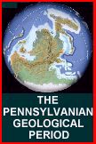
North
America and Europe from the northern hemisphere smashed
together along the cost
of northeastern Canada and Greenland, forming the continent
of Laurussia. This continent
moved southward towards the equator finally colliding
with the continent of
Gondwana, formed from the collision of South America
Africa. This created the super
continent known as Pangea.
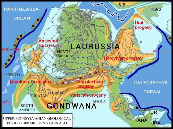
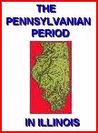
Drawing
borrowed from the web pages of Dr. Ronald Blakey,
professor of Geology, Northern Arizona University
What
is listed on the illustration as the Appalachian Orogeny
and the Variscan Orogeny,
are the Appalachian Mountains in the U.S. and the Variscan
in north Africa, which were formed by this collision.
The Yucatan peninsula, Florida, and part of Central
America were jammed into the gulf cost, so the Gulf
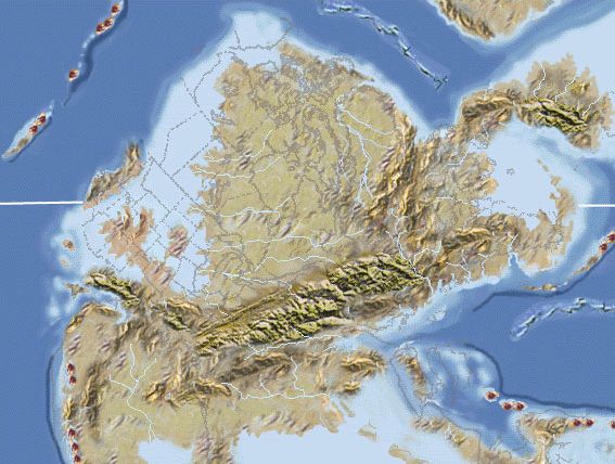
of Mexico did not exist. If you look carefully
above the "O" following
the label Marathon Ouachita, you can see the outline
of Illinois and Missouri, mostly in light blue, with
the green delta of the ancient Michigan River.
The blue represents relatively shallow coastal water,
or in this case an inland sea connected to the west
coast. Notice the location of the equator which
is almost completely into Canada.
The
collision between Siberia and Eastern Europe (Upper
right) created the Ural Mountains, and China was formed
with the collision of several micro continents and Siberia.
In
the bottom right corner, on the east cost of Africa
are Iran, Arabia, Turkey, and further northwest is the
outline of Italy and Greece.