|
THE
ILLINOIS BASIN
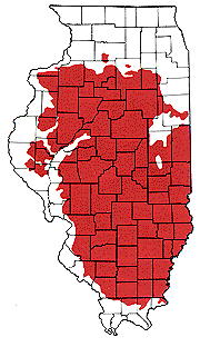
In
Illinois the youngest Pennsylvanian strata lies in southeastern
Illinois and is surrounded by progressively older strata.
Such an age distribution, with the young- est in the center,
and progressively older strata surrounding it results from
the broad downwarp of the Illinois basin. Almost all of
Illinois, Southwest Indiana and western Kentucky are part
of the Illinois Basin, a sub circular or spoon shaped depression
250 to 300 miles in diameter.
The
above figure is a structure map of Cambrian strata that
allows one to "see" below the ground surface to the top
of the Cambrian strata.
|
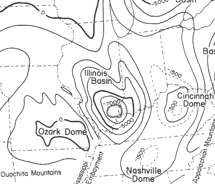
Figure
from: A View of the Past - An Introduction to Illinois Geology,
Christopher J. Schuberth,
Illinois State Museum
In
north-central Illinois it appears on or near the surface,
but in southeastern Illinois it lies nearly 7,000 feet underground.
This basin structure is where most of the coal in the state
is located.
|


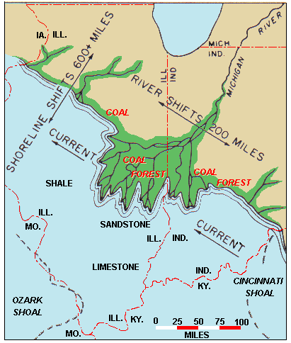 The
ancient Michigan River was building immense deltas out into
the shallow Chicago sea, carrying in sediment from southeast
Canada. While
sand, silt and lime were accumulating in the sea, forming
sandstone, shale and limestone, coastal coal swamps flourished
on the adjacent lands along the deltas. The plant debris
from these swamps accumulated in thick mats of peat and
eventually turned into Illinois coal.
The
ancient Michigan River was building immense deltas out into
the shallow Chicago sea, carrying in sediment from southeast
Canada. While
sand, silt and lime were accumulating in the sea, forming
sandstone, shale and limestone, coastal coal swamps flourished
on the adjacent lands along the deltas. The plant debris
from these swamps accumulated in thick mats of peat and
eventually turned into Illinois coal.